

You’re buying a semi in Leeds and the plan shows the rear fence sits 0.6 m beyond the plotted boundary. You can’t treat a survey as a guarantee; you need to know what type it is, what it measures, and what it leaves out. If you misread bearings, miss a monument, or ignore an easement note, you could inherit a dispute or lose usable space. The next steps show how to test the plan against what’s on site.
Key Takeaways
- Identify the survey type you need—topographic, measured building, as-built, boundary, or setting-out—based on your project or dispute.
- Check what the survey reveals: boundary lines, dimensions, area, and fixed features like walls, fences, and buildings.
- Read essentials first: legend, north point, scale, datum, tolerances, and any “subject to” notes affecting interpretation.
- Locate boundaries on site using bearings, distances, offsets, and physical markers, then verify against title and transfer plans.
- Understand limits: surveys show physical evidence, not legal ownership; use RICS-insured surveyors and consult deeds for rights and easements.
What a Property Survey Shows (and What It Won’t)
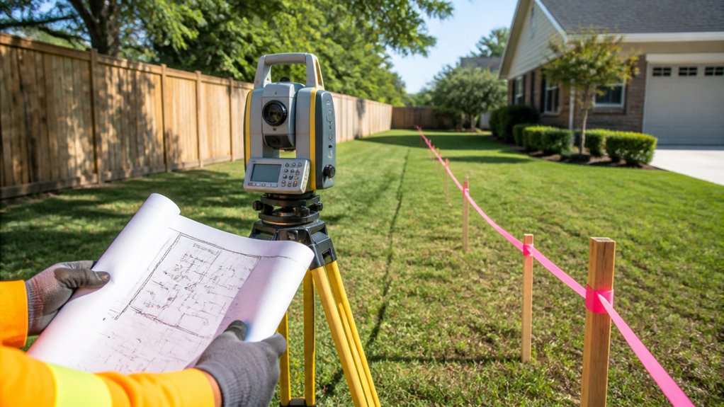
Although a property survey can look like a simple plan, it actually sets out the key legal and physical facts about your land: the boundary lines the surveyor has measured, the plot’s dimensions and total area, and the location of fixed features such as buildings, walls, fences, drives, and accessways.
You’ll use it to check what’s on site against your conveyancing papers and spot risks before you join the neighbourhood.
Property survey accuracy depends on clear control points, on‑site access, and whether evidence such as original markers survives.
Always check Surveyor credentials: in the UK you’ll want an RICS‑regulated firm and a named surveyor with appropriate insurance.
What it won’t do is resolve ownership disputes, interpret covenants, or replace Land Registry title plans, which are general boundary only.
Common Property Survey Types (and When Each Is Used)
Once you know what a survey can and can’t tell you about boundaries, area, and fixed features, the next step is choosing the right survey type for your purpose—because UK surveyors produce several standard outputs, each with a different level of detail, method, and legal weight.
A topographic survey plots buildings, kerbs, levels, and services for design work.
A measured building survey captures internal layouts, elevations, and floor areas to RICS-style conventions.
An as-built survey verifies what’s constructed against drawings, often with control points for repeatability.
A boundary survey ties visible occupation features to OS and title plans, supported by Historical land records where needed.
A setting-out survey transfers coordinates to the ground for contractors.
Your survey equipment comparison matters: GNSS suits open sites; total stations help in streets; laser scanners speed complex facades.
When You Need a Property Survey (and When You Don’t)
You’ll usually need a property survey before you buy or sell, especially if the title plan is unclear or you’re altering boundaries.
You should also instruct a chartered surveyor if you’ve got a boundary or fence dispute, as measured evidence can support negotiations or Land Registry applications.
You often don’t need a new survey for routine ownership where existing plans are reliable and no works, disputes, or conveyancing checks are in play.
Before Buying Or Selling
When should you commission a property survey before buying or selling in the UK? Do it before you exchange contracts, once your offer’s accepted, so you can renegotiate or walk away.
You’ll want a survey for older homes, extensions, conversions, or anything non-standard (timber frame, thatch, flats with unusual leases). It’s also wise where Historical property data shows past subsidence claims, underpinning, mining searches, or repeat insurance repairs.
Commission one too if you need clarity on Environmental impact: flood risk, coastal erosion, contaminated land, radon, or nearby infrastructure schemes.
You may skip a survey on a new-build with a robust warranty and clear documentation, but you’ll still benefit from a snagging inspection to align with local buyer expectations.
Boundary Or Fence Disputes
How do you know if a wonky fence is just a maintenance issue or a true boundary problem? If you’ve got recurring neighbour tension, mismatched Fence alignment to old posts, or a new patio edging near the line, you need evidence, not guesses.
Start by checking your title plan and any transfer plan, but remember UK Land Registry plans are general boundaries. When positions matter, instruct a RICS chartered surveyor to carry out a measured survey and set out the likely legal boundary from deeds, features, and occupation.
You’ll get Boundary clarification you can share calmly, keeping things neighbourly and within the community. Use the survey to agree a line, record it in writing, and, if needed, support mediation or a determined boundary application.
Routine Ownership Exceptions
Although most day‑to‑day ownership jobs don’t justify the cost of a full measured survey, a few routine exceptions do—typically where you’re fixing something to the ground, relying on exact dimensions, or exposing yourself to future dispute—so treat surveys as a targeted risk‑control tool rather than a default purchase.
Get one before you pour new footings, extend, add a dropped kerb, or install drainage, because offsets to boundaries and easements matter. A survey also helps when you’re replacing a wall, setting retaining structures, or building near shared access where the Ordnance Survey base plan won’t be accurate enough.
Check your Land Registry title plan and register, then map any title restrictions, covenants, or rights of way onto the ground. If neighbours agree informally, you’ll still want plans that stand up to lenders, insurers, and future buyers. It keeps you aligned with local practice.
How to Read Bearings and Distances on a Property Survey

Before you can plot a boundary line from a UK property survey, you need to decode two things in the “bearings and distances” schedule: the direction of each line (the bearing) and its length (the distance).
Bearings are usually shown as degrees and minutes from north (e.g., N 23°15′ E) or as whole-circle bearings (e.g., 043°15′). Read them as a turn from north or south toward east or west.
Distances follow each bearing and should state measurement units, commonly metres, sometimes millimetres on plans; don’t mix them when sketching.
Check the survey accuracy note: it tells you whether figures are measured, scaled, or rounded.
Work line by line in order, keeping the same orientation, so your plot stays consistent with the surveyor’s intent and local practice.
How to Find Corners, Monuments, and Property Lines
Now you’ll use the survey’s dimensions to locate corner markers on the ground, starting from a fixed feature such as a boundary wall, fence line, or building corner shown on the plan.
You’ll look for monuments like metal pins, concrete posts, or OS/utility markers and confirm them by checking bearings and tape-measured distances match the survey.
Once you’ve fixed two corners, you can trace the property line between them and mark it temporarily with string or chalk to verify it aligns with the physical boundary.
Locating Corner Markers
To locate your boundary with confidence, start by finding the physical corner markers (often called monuments) that tie the legal description to what’s on the ground. Check your survey plan for symbols such as iron pins, concrete posts, drill holes, or OS bench marks, then visit those points first.
Bring a tape, a probing rod, and a magnet to spot buried metal. Look along fence junctions, hedge bases, kerb returns, and wall ends where surveyors commonly set Property markers. If you find a tag, cap, or stamped pin, photograph it, note its condition, and record a rough GPS reading.
Treat Boundary markers as evidence, not proof: don’t move them, and avoid digging near services without a locator scan. If anything’s missing, consult a chartered surveyor.
Tracing Property Lines
Once you’ve identified at least two reliable monuments, trace the property lines by linking those fixed points to the bearings and distances on your survey plan, then checking what’s physically there along each run. Use a tape and compass, or a GNSS receiver if you’ve got access, and work systematically from corner to corner.
Look for hedgebanks, ditches, walls, and post-and-wire that often reflect Historical boundaries, even if the Land Registry title plan is general.
At each line, confirm change points: fence angles, masonry returns, or old iron pins. Record offsets where features sit inside or outside the surveyed line.
If evidence conflicts, don’t move markers; you’ll need a chartered land surveyor to reconcile Land ownership with measured facts.
How to Spot Easements and Rights-of-Way on a Property Survey
Although a property survey can look like a dense patchwork of lines and notes, you can usually spot easements and rights‑of‑way by scanning for specific labels, boundary markings, and referenced deeds.
Look for annotations such as “easement”, “servitude”, “wayleave”, “access”, “drainage”, or “rights of way”, often shown with dashed lines, hatching, or corridor widths.
Check the legend for Easement types and confirm symbols used for public footpaths, bridleways, or private access routes.
Surveyors may cite a Land Registry title number, deed date, or “subject to” note; follow these references in the title register and plan.
If you’re in a shared driveway or estate road, note any coloured edging that indicates who benefits and who bears maintenance duties.
How to Identify Encroachments and Boundary Disputes
When you suspect a neighbour’s fence, wall, extension, or hedge sits in the wrong place, a property survey gives you the quickest way to test that suspicion against the legal boundary. Start by matching fixed features on site to the survey’s measured offsets from permanent reference points (walls, kerbs, manholes).
If the line of occupation differs from the surveyed Property boundary, note where the divergence begins and ends, and measure the maximum “overstep” in millimetres.
For Encroachment identification, look for structures crossing the boundary line, overhanging eaves, or planted screening that’s rooted on your side. Photograph each point with a scale, keep dated notes, and speak calmly with your neighbour so you stay on the front foot before positions harden into a dispute.
How to Read the Legend, Notes, and Surveyor’s Stamp
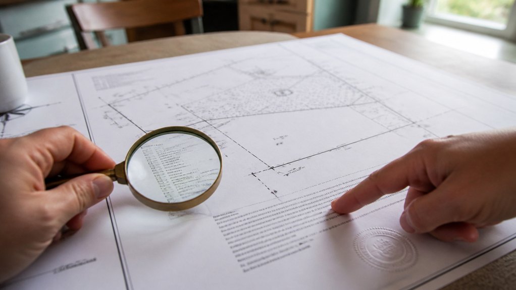
Before you rely on any linework on the plan, check the legend, general notes, and the surveyor’s stamp because they tell you exactly what the drawing means in legal and measurement terms.
Start with legend interpretation: match each symbol, hatch, and line type to its meaning, such as fences, walls, kerbs, or boundary indicators.
Then read the general notes for datum, scale, orientation, and any stated tolerances, so you don’t treat approximate features as fixed.
Pay close attention to survey annotations showing measured offsets, tie lines, and control points; they’re your trail back to how positions were derived.
Finally, confirm the surveyor’s stamp, signature, date, and firm details, plus RICS or CICES membership where shown, so you’re working from an accountable, current survey deliverable.
What to Do When a Property Survey Flags Problems
If your survey highlights a boundary mismatch, an encroachment, or a missing right of way, treat it as a decision point rather than a defect on paper.
Ask your conveyancer to compare the plan with the Land Registry title, transfer, and any deed plans, then confirm whether the discrepancy is legal or physical.
Check Property survey accuracy: verify the survey’s scale, date, control points, and whether features were measured or inferred.
Next, confirm Surveyor qualifications (RICS/Chartered, PI cover) and request a written clarification or updated plan if evidence is weak.
Where neighbours are involved, open a calm discussion and record it.
If risk remains, you can renegotiate, seek an indemnity policy, agree a boundary, or walk away before exchange.
Conclusion
Once you can read a property survey, you’re no longer steering your land blindfolded—you’re holding the site’s map and compass. You’ll know what the plan confirms, what it can’t promise, and where the legal edges really sit. Check bearings, dimensions, monuments, and the legend, then cross‑reference with HM Land Registry and any deeds. If the survey flags easements or encroachments, act early: speak to a chartered surveyor, then get legal advice.
About the Author